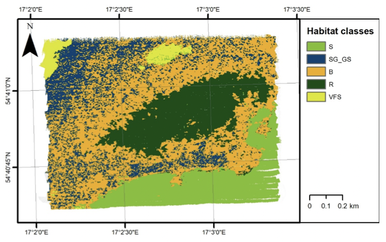
In years 2017–2020 NORBIT was collaborating with an international scientists team on the ECOMAP BONUS project funded by the EU. It was dedicated to explore the use of swath devices and shallow marine seismic and LIDAR measurements to study the seabed environment. As an important partner NORBIT was providing knowledge and dedicated multibeam sonars with calibrated backscatter for the optimization of backscatter processing and development of habitat mapping methods. This paper by Trzcinska et al. is describing in detail how to process the echo signal and showing how NORBIT based backscatter curves can be used for bottom classification at different frequencies.
Read the case study HERE / PDF