Article as PDF HERE
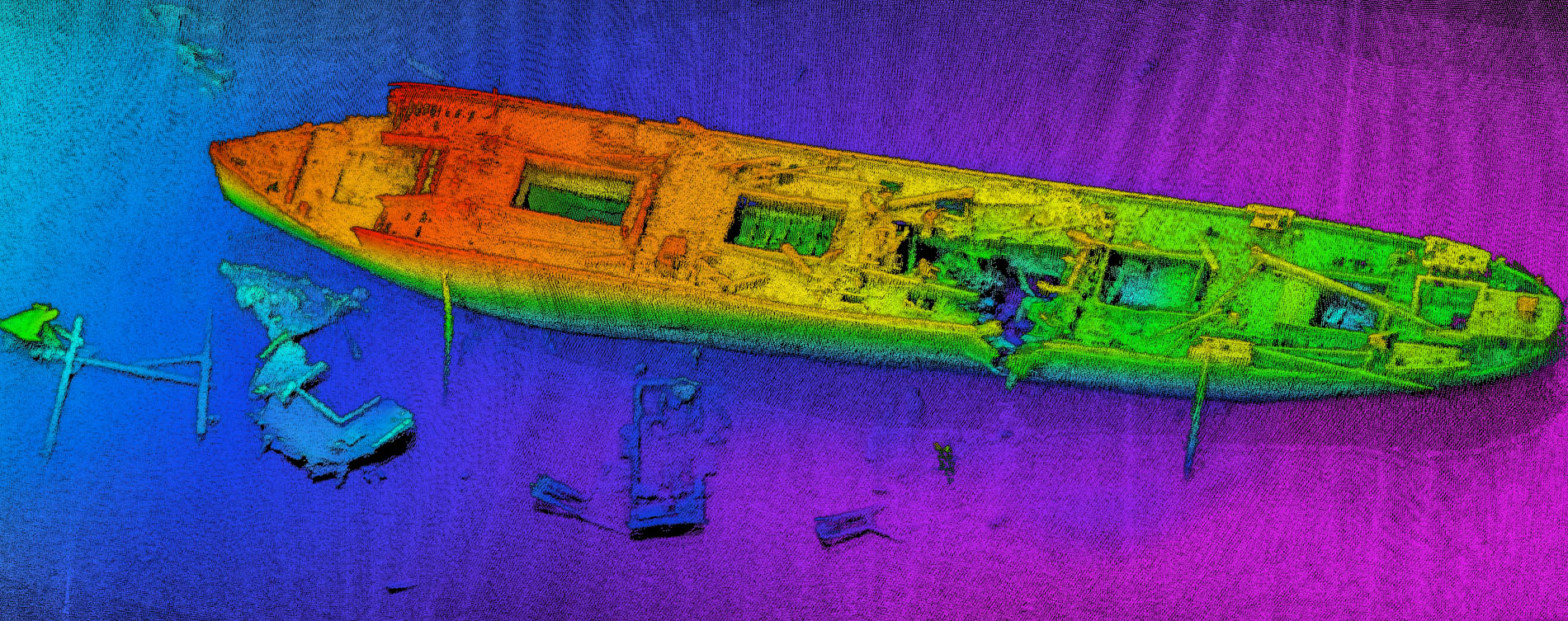
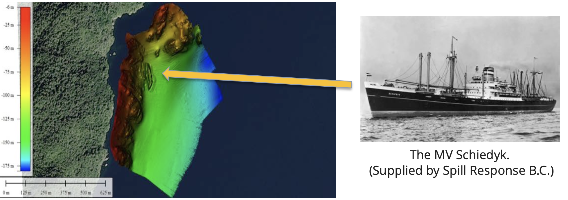
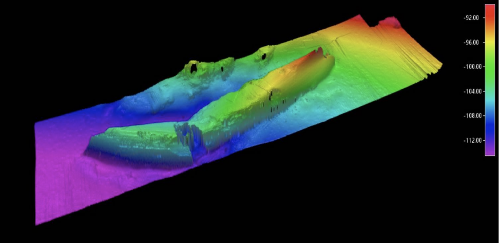
This Case Study is prepared from multibeam surveys using a NORBIT WINGHEAD multibeam echo sounder to perform a technical assessment of the MV Schiedyk. The more than 50-year old shipwreck near Bligh Island off the west coast of Vancouver Island was confirmed to be the source of several reports of sheen observed in the ZuciarteChannel and Nootka Sound in the fall of 2020.
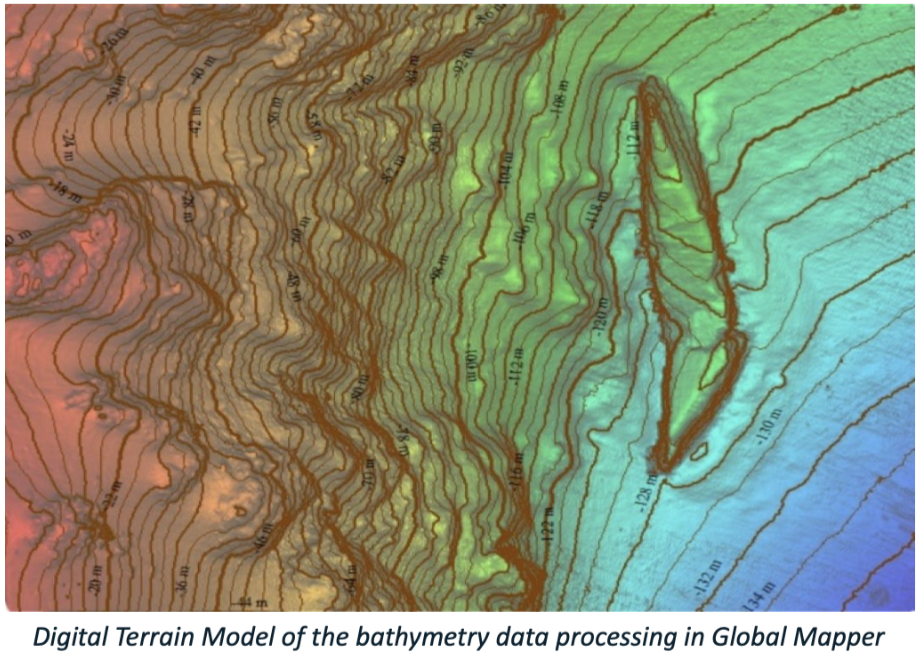
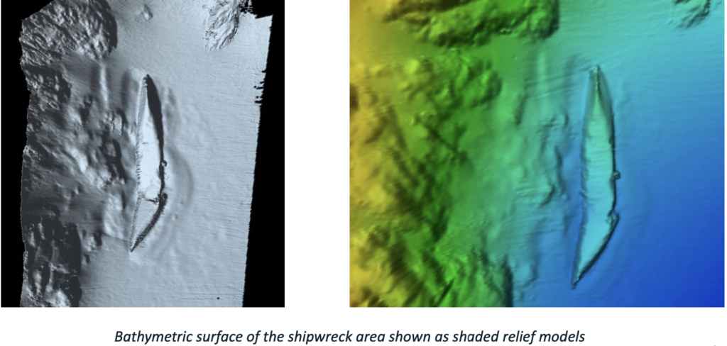
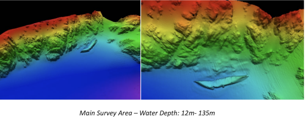
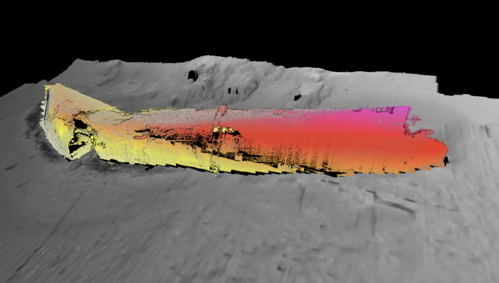
The MV Schiedyk is a 147-metre (483 ft) cargo ship that sank on January 3, 1968 after striking a submerged ledge. The shipwreck is located 106 to 122 meters (350 to 400 ft) below the surface.
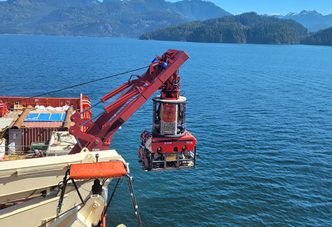
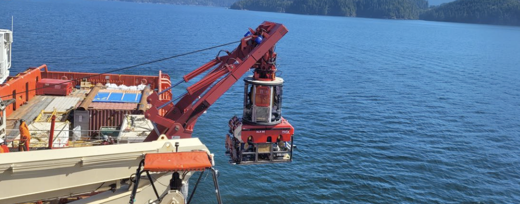
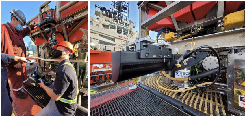
ROV main integration details
All survey equipment was installed on ROV model XLX 66.
- MBES NORBIT WINGHEAD Wideband Multibeam Sonar for High Resolution Bathymetry
- Integrated Sound velocity sensor on Sonar Head
- NORBIT WBMS-FLS Broadband
- Positioning system VERIPOS LD5 Integrated Mobile Unit.
- Inertial sensor iXblue PHINS in SUBSEA Bottle for ROV
- Kongsberg HiPAP 501 – Acoustic Positioning System
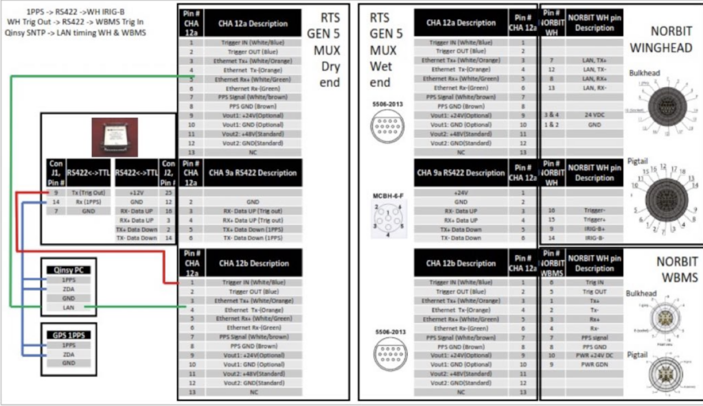
General integration principle and cable schematics
From this cable schematics, we can summarize that all of the NAV is consolidated on the ROV (IMU, DVL, USBL) in the PHiNS C3 INS. This is streamed topside to QINSy on Ethernet. The INS receives ZDA from surface Fiber Optic converter.
A customized pigtail connects the MUX to the head. The PPS is converted to TTL and goes to the WINGHEAD sonar head. It is assumed that the trigger in/out is only required for syncing dual heads; which is not relevant to this installation scenario.
Acquisition and post-processing software
- All of the necessary data and calibration functions are included in the NORBIT GUI used together with NORBIT’s data acquisition software (DCT).
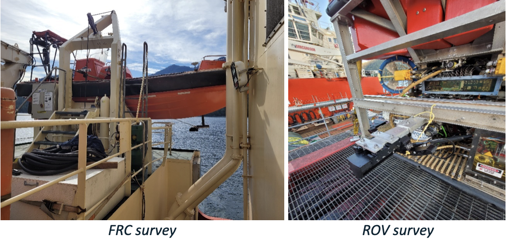
- For the survey carried out from the FRC boat NORBIT GUI and DCT were used as the main acquisition tools
- For the survey carried out from the ROV the main acquisition software was QPS QINSy.
Acquisition software | WBMS GUI and DCT (Data Collection Tool)
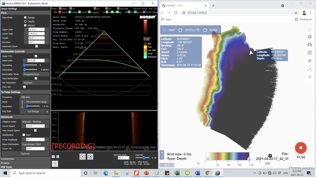
Bathymetric surveys with NORBIT WINGHEAD – 400 kHz
- Mapping of the water column (i.e., the marine environments between the ocean surface and the sea floor) is a non-destructive acoustic method using sonar systems, such as multibeam echo sounders.
- Water column data is a by-product of the information about the seafloor collected by the sonar. This information is captured from the sounds that are reflected back to the sonar transducer after being scattered by particles within the water column. These include features such as fish, plumes, gas bubbles etc. The information is often referred as water column backscatter data.
- The system employed offers a unique ability obtain highest Signal to Noise ratio with highest resolution via an 80kHz signal sweep bandwidth and up to 1.6ms pulse lengths
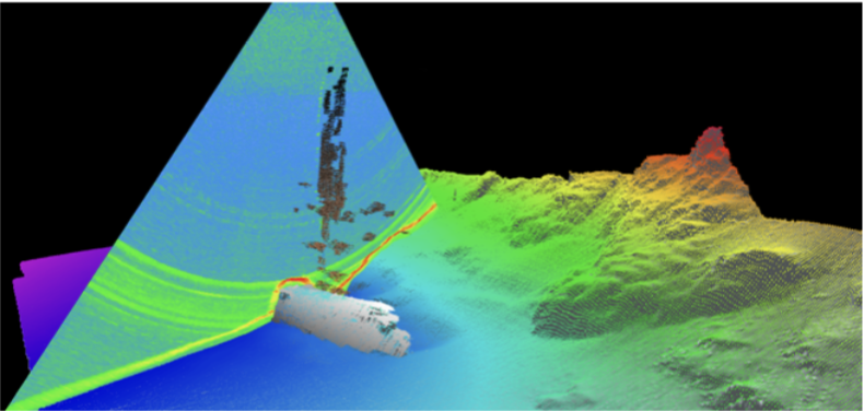
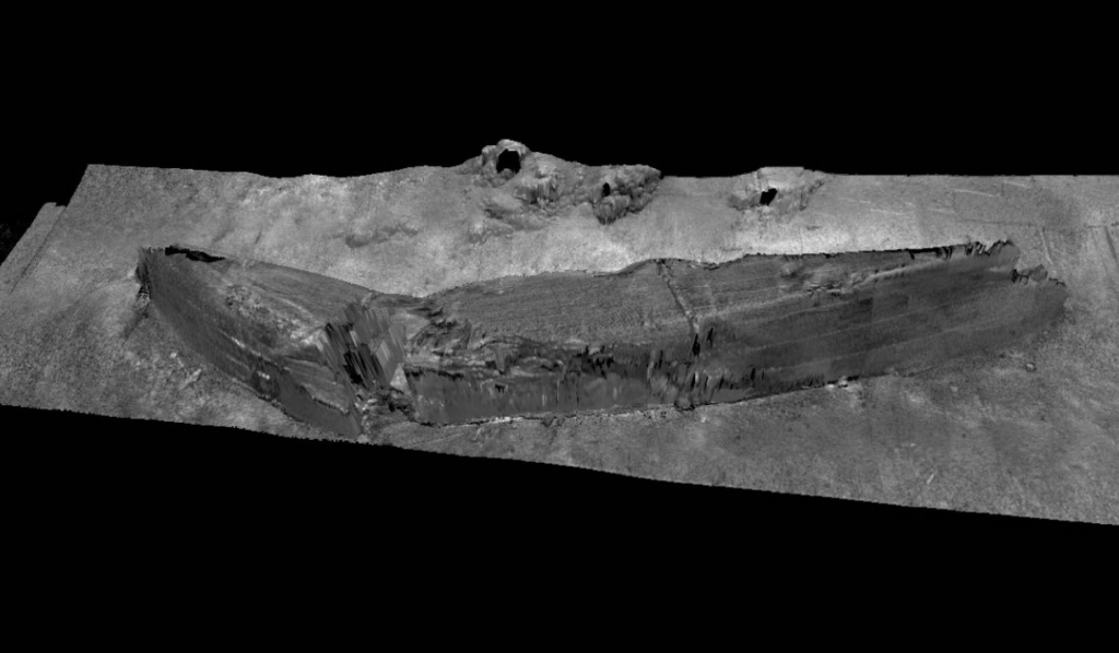
General bathymetry of the area – 400 kHz
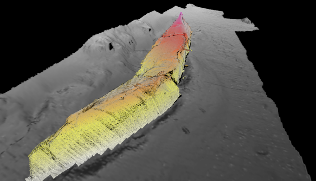
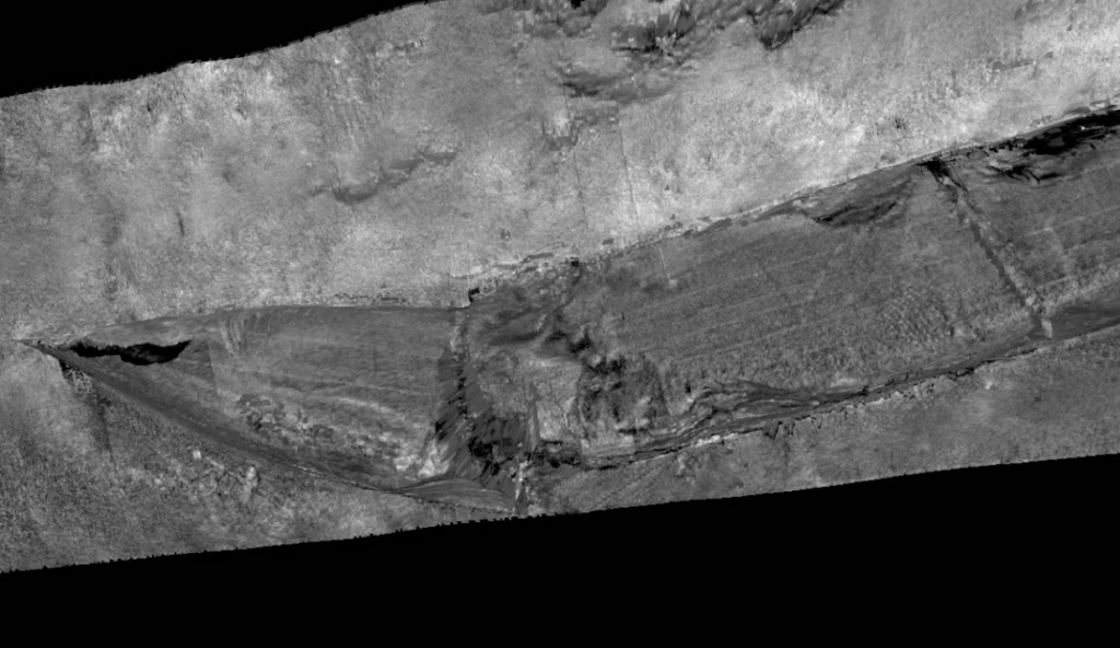
Bathymetry and Water Column Data results from FRC – 400 kHz
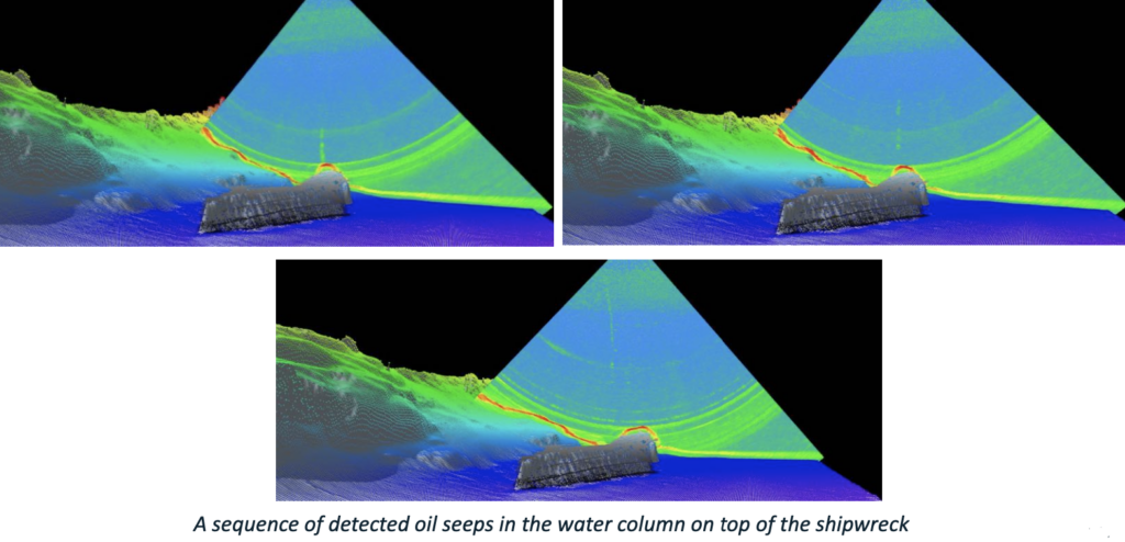
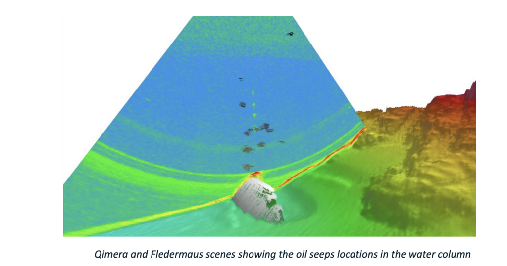
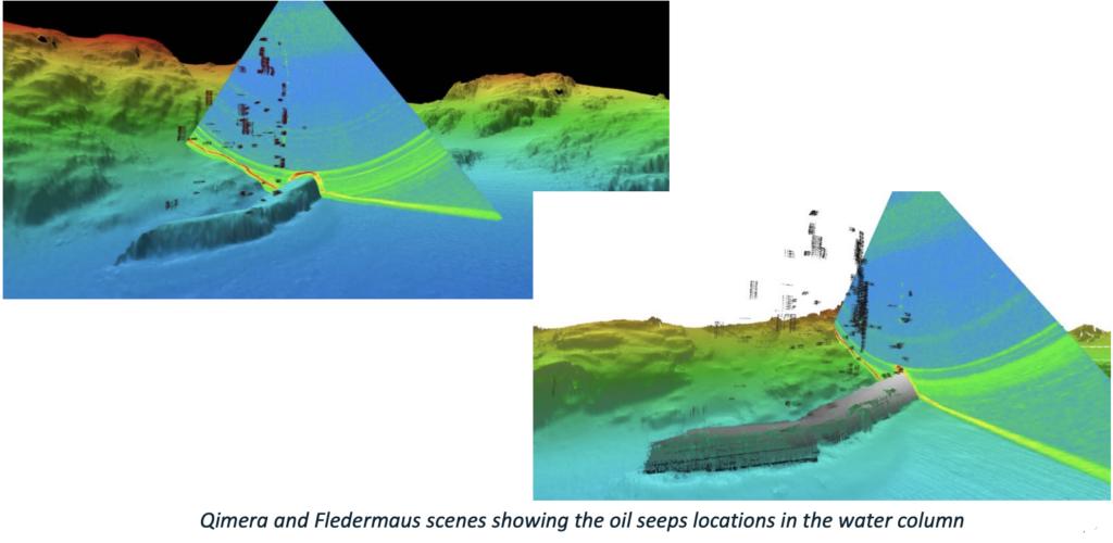
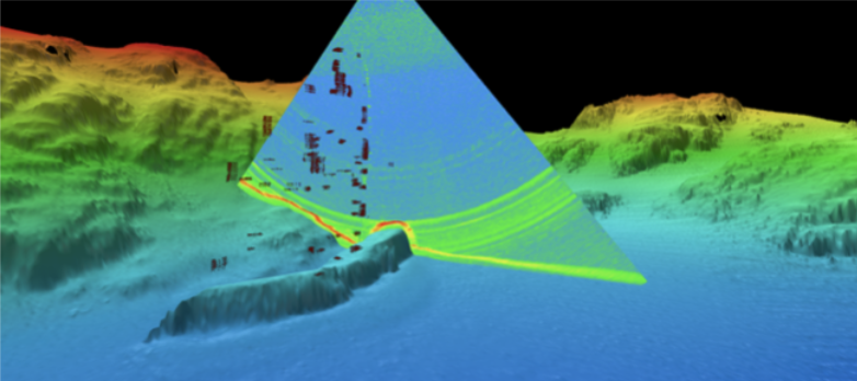
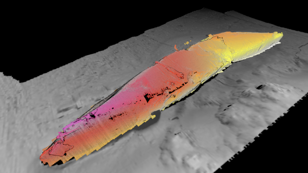
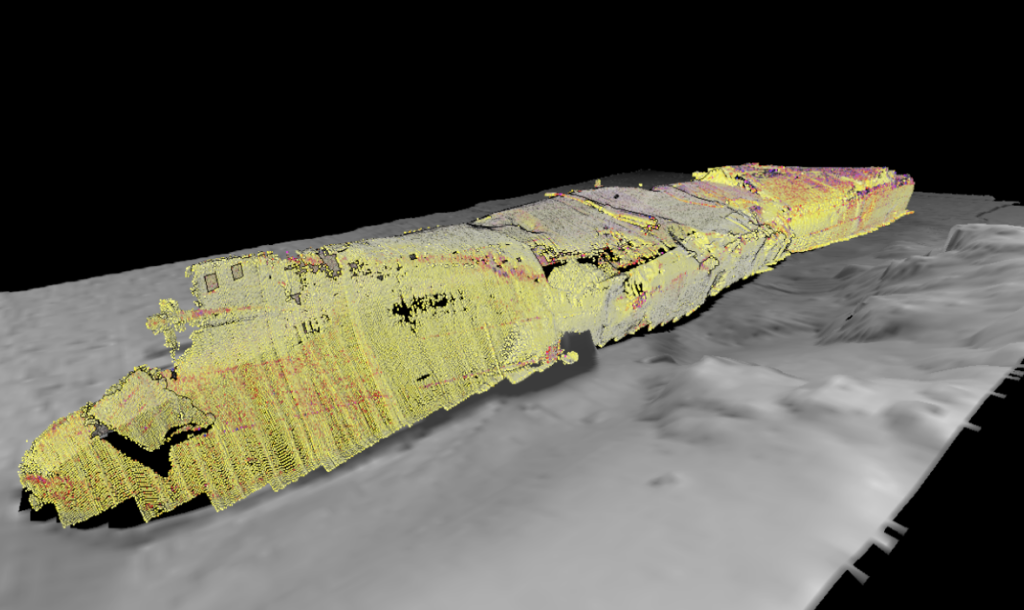
Bathymetry over backscatter data results from the ROV Survey – 400 kHz
Acknowledgements:
Canadian Coast Guard
Aaron Josef with Resolve Marine
Seahorse Geomatics