- This case study highlights the key benefits of NORBIT’s cutting-edge iWBMS X multibeam survey system, with Applanix OceanMaster integration and motion Stabilisation .
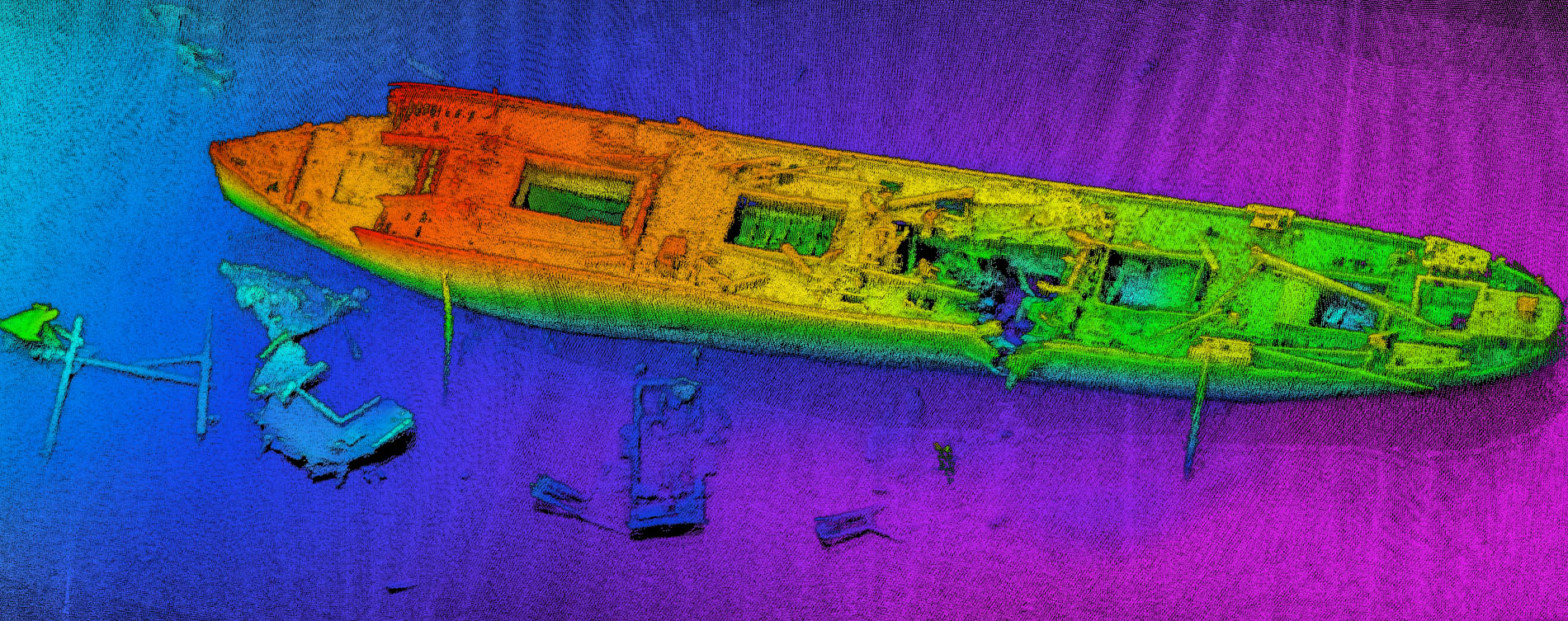
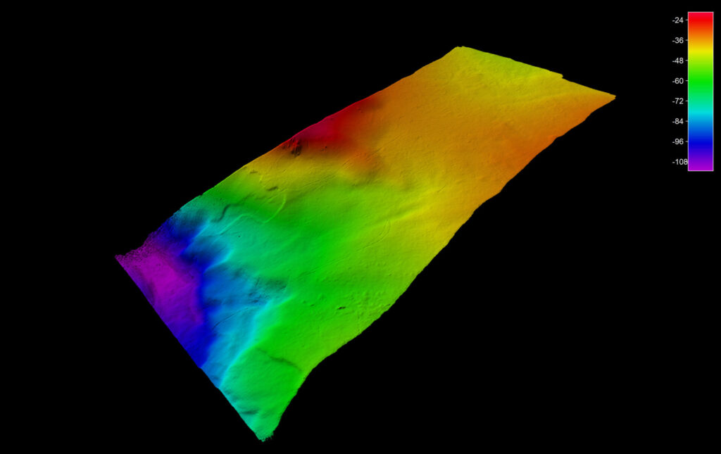
- Data for the case study was collected in the Trondheim Fjord in Norway, with depths ranging from 20 to 100m.
- We explore how the latest advancements are transforming capabilities and industry benchmarks, while significantly enhancing the user experience and delivering substantial efficiency gains for the user.
- Sensors used:
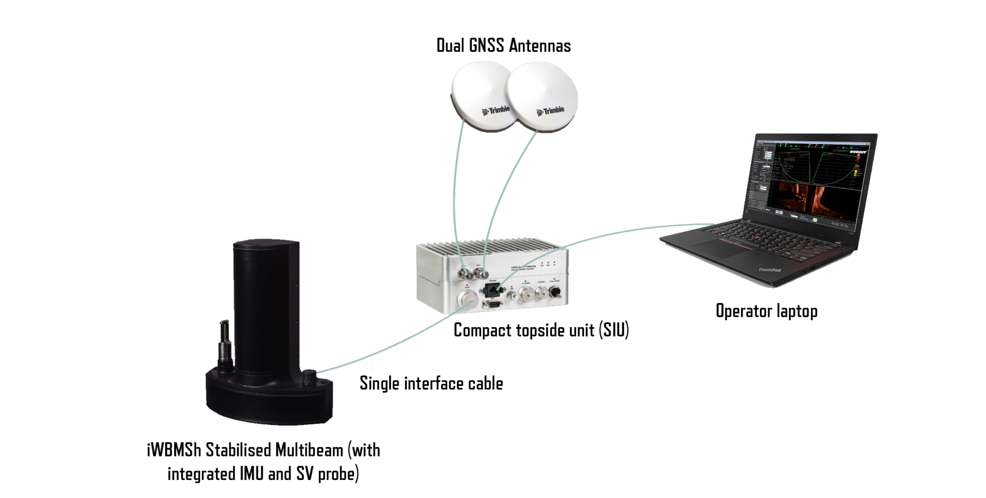
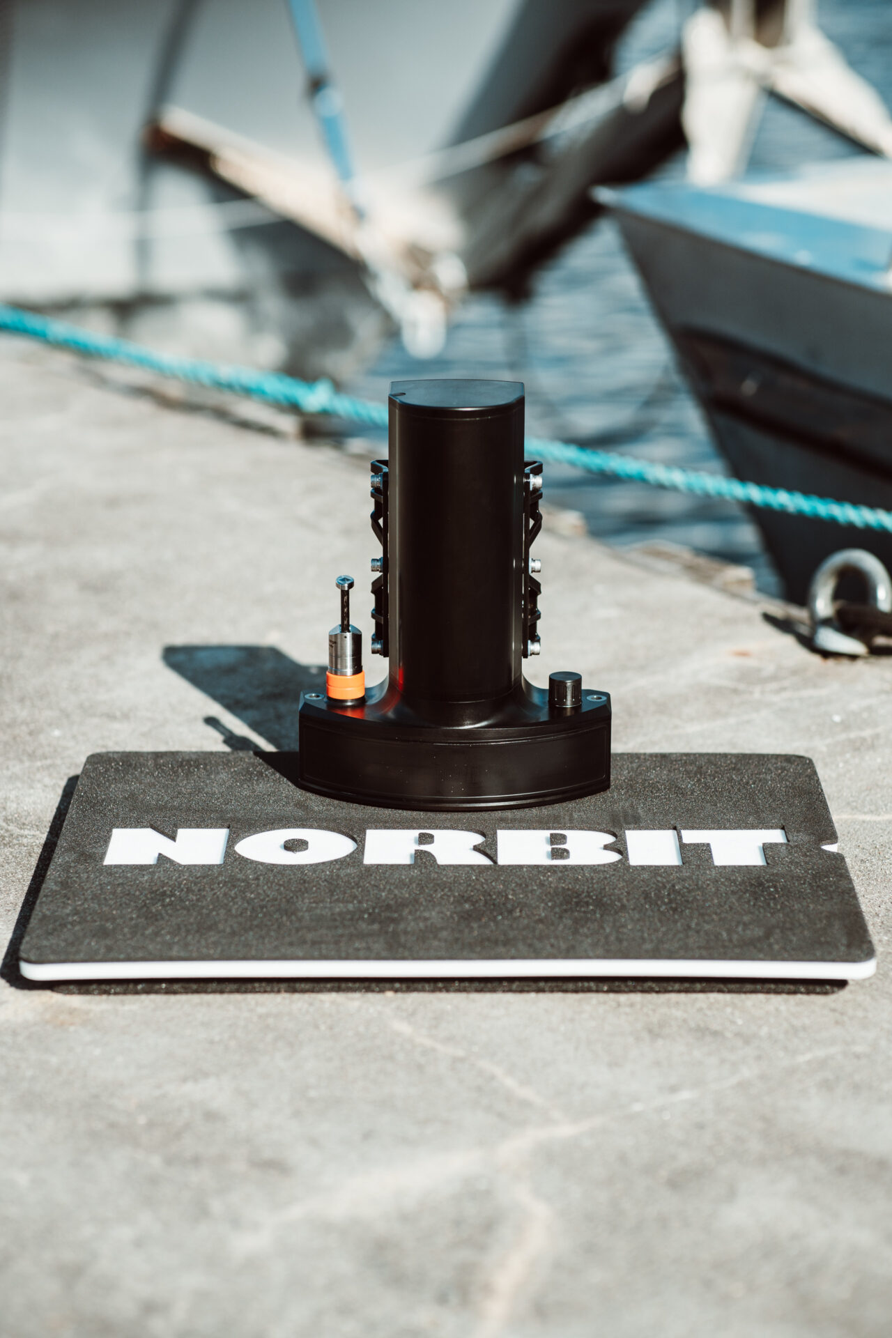
- NORBIT iWBMS X Stabilised, featuring integrated Applanix OceanMaster GNSS/INS system.
- NORBIT Sound Velocity Profiler.
Key Specifications
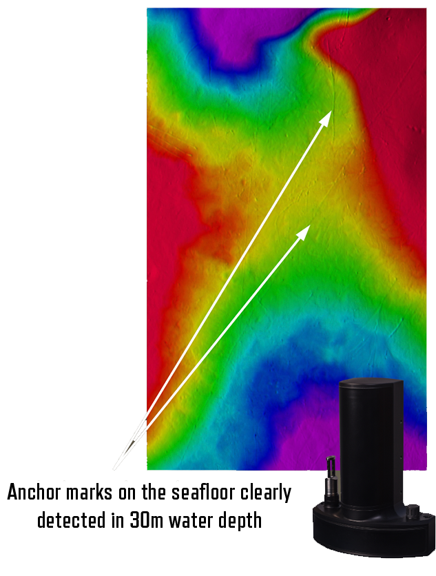
The iWBMS Xh Stabilised is the most compact and lightweight high-resolution system from NORBIT to date, offering 0.9×0.9-degree beam widths at 400kHz frequency.
- The Applanix OceanMaster Inertial Measurement Unit (IMU) is tightly embedded, offering 0.01-degree roll and pitch accuracy and 0.02-degree heading accuracy.
- The multibeam is frequency agile from 200-700kHz.
- Full motion stabilisation (roll, pitch and yaw) with up to 2048 beams.
- The full wet-end weighs just 6.5kg in air and contains one interface cable from wet-end to dry-end for rapid mobilisation.
- This efficient configuration enhances ease of use and portability while preserving peak performance levels.
Simple Hardware Setup
Full Motion Stabilisation
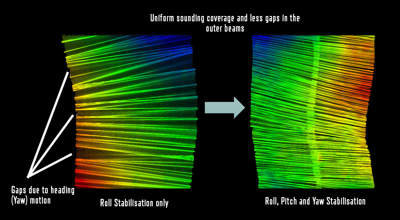
Traditional multibeam systems offer roll stabilisation as a standard feature to compensate for vessel roll motion in dynamic sea states, optimising swath coverage.
In addition to roll stabilisation, the iWBMS Xh Stabilised sonar offers pitch and yaw stabilisation with 1024 beams per ping, providing fully motion-stabilised data and evenly distributed soundings on the seafloor.
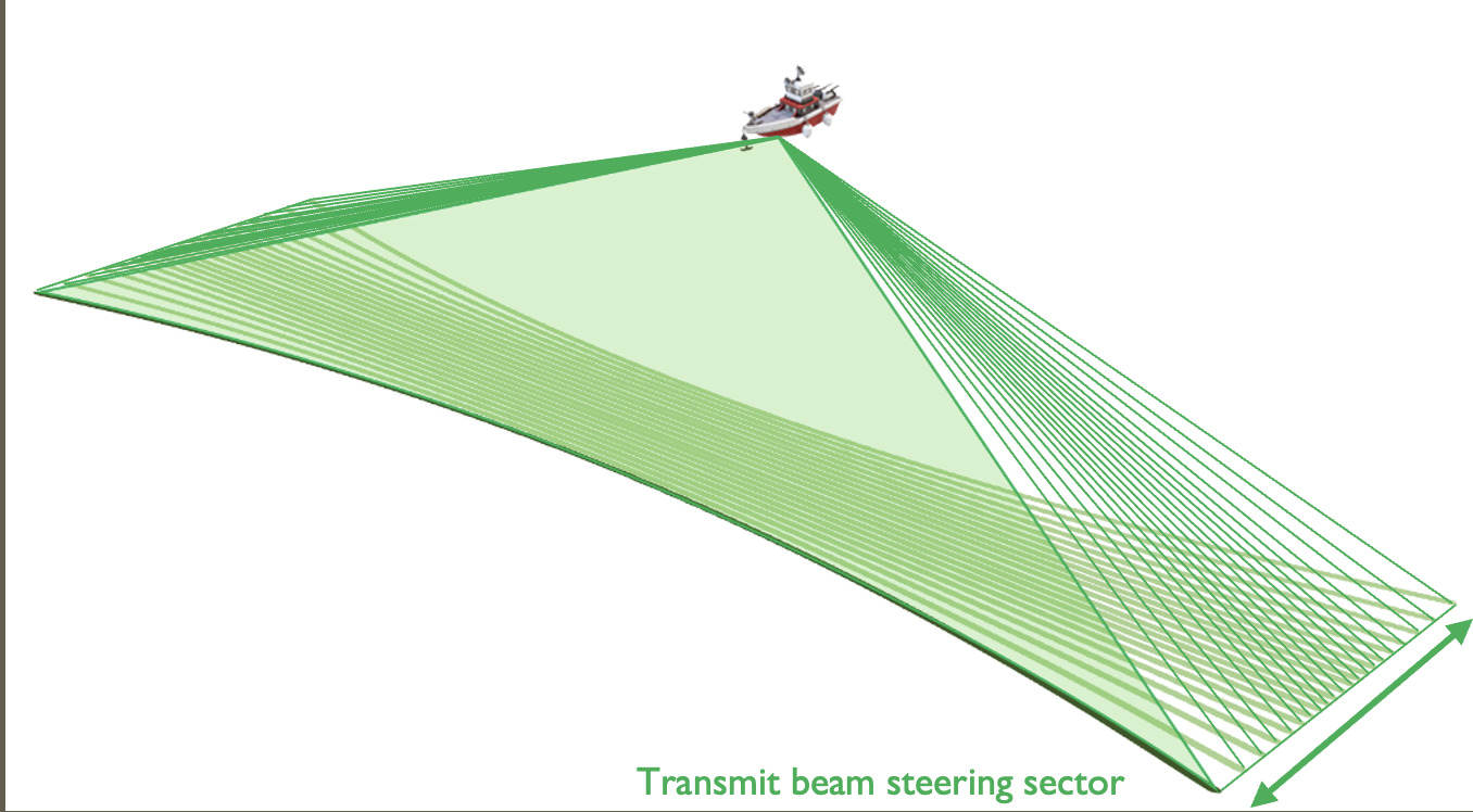
- Transmit beam steering actively compensates for pitch movements and unintended (but normal) changes in vessel heading.
- Prevents gaps in coverage, requiring less infill and reducing the time required to complete the survey.
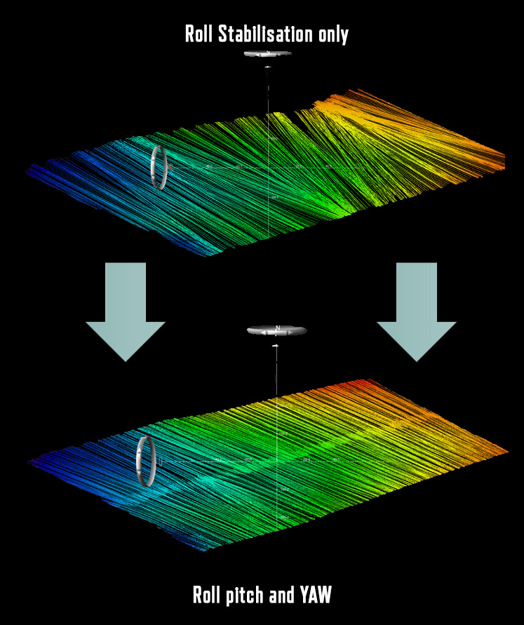
Sounding Coverage with Full Motion Stabilisation
Example of Yaw Stabilisation activation in situation with high vessel motion
Dual Swath
The Dual Swath feature enables the sonar to transmit multiple pings simultaneously (2048 beams) providing substantial efficiency gains for the user.
- This allows higher sounding density when the same survey speed is maintained as a traditional single swath configuration, making it easier to satisfy sounding density requirements for the project.
- Alternatively, the survey speed can be increased to reduce the time required to complete the survey, while preserving the equivalent sounding density as in the standard (single swath) configuration.
DTM coloured by sounding density, showing higher density with Dual Swath activated.
STX Scanning
The STX scanning feature directs the sonar to sweep an along-track sector to enhance coverage behind pillars and quay walls.
- Conventional sonars lack the capability to capture information from these obstructed areas, resulting in data gaps.
- NORBIT’s steerable transmission technology steers the transmit beam in a 20-degree sector, allowing it to effectively survey regions that are typically inaccessible to traditional multibeam systems.
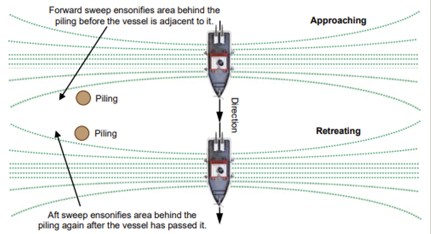
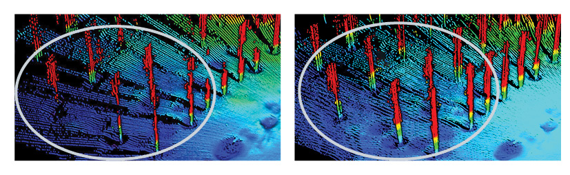
Data example of STX scanning.
On the images below the advantages of STX scanning is shown as many shadows behind the pillars are eliminated.
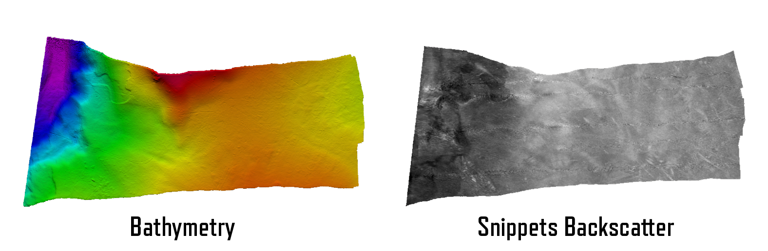
Backscatter
The iWBMS Xh Stabilised can produce bathymetry and multiple forms of backscatter data simultaneously:
- Sidescan
- Snippets
- Bathy intensity (intensity at the bottom detection point)
- Water column
The backscattering strength output option (BSO) provides fully repeatable backscatter results, as well as compatibility with physical models.
- It demonstrates how strong, in absolute form, the bottom reflects transmitted acoustic signals and can be used for seafloor classification purposes.
Applications
Coastal Zone and Offshore Bathymetry: Achieve unparalleled precision in mapping coastal and offshore areas.
Pipeline Surveys: Collect accurate data for pipeline inspection and maintenance, raising the bar for pipeline integrity assessment.
Pond, River, and Estuary Surveys: Seamlessly adapt to different water bodies, ensuring precise data collection.
Harbour and Lake Surveys: Enhance safety and precision in dynamic maritime environments.
USV Readiness: Seamlessly integrate with unmanned surface vehicles, taking advantage of the iWBMS Xh Stabilised’s compact form, ease of installation and low power consumption.