Read as PDF
Introduction
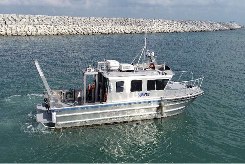
LIA Engineering and Surveying was commissioned by the Israel Electric Corporation (IEC) to conduct a combined survey of a nearshore jetty. One of the jetty’s supporting piles was hit by a large vessel. The main purpose of the survey was to access the extent of the damage and overall structural integrity.

Equipment
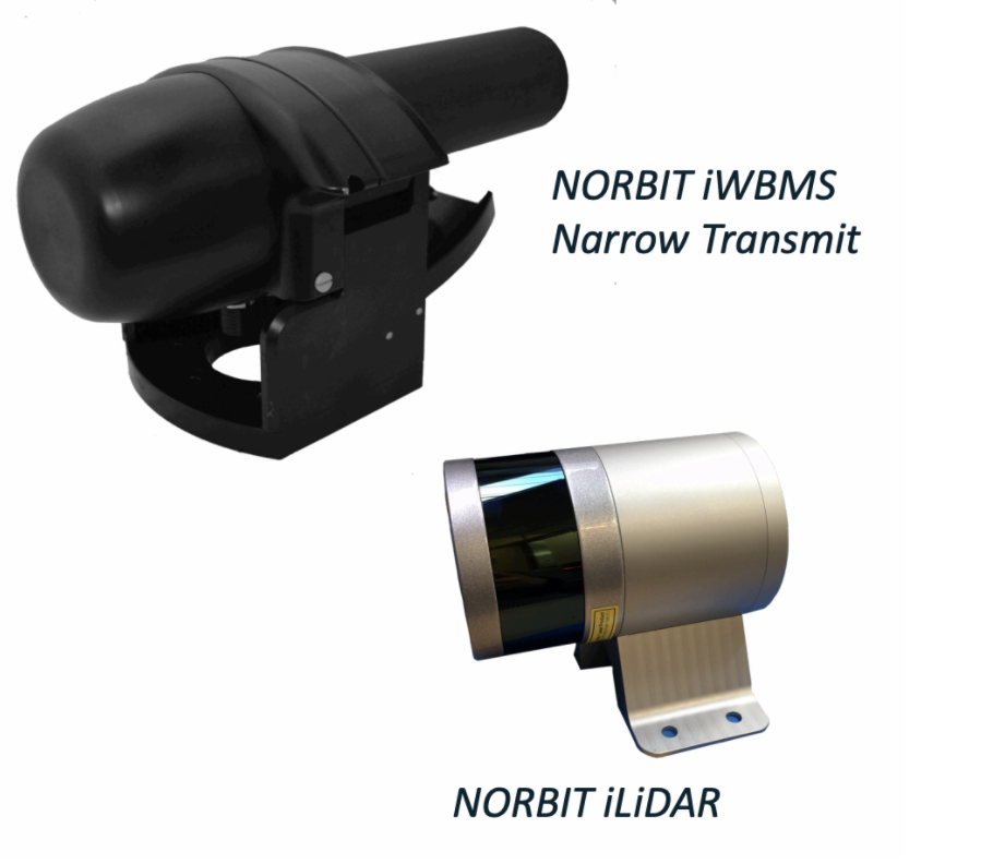
LIA used a combination of the NORBIT iWBMS Narrow Transmit turn-key multibeam system integrated with the NORBIT iLiDAR to create a homogeneous model of the jetty: from the sea bottom to the above water platform.
Survey
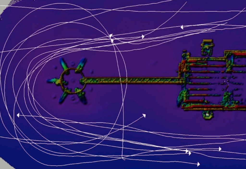
The area was surveyed from several directions in order to ensure maximum horizontal and vertical coverage thus avoiding data shadows.
Results
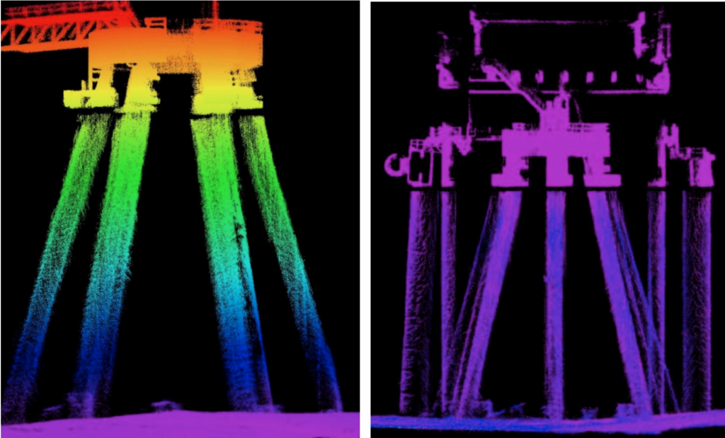
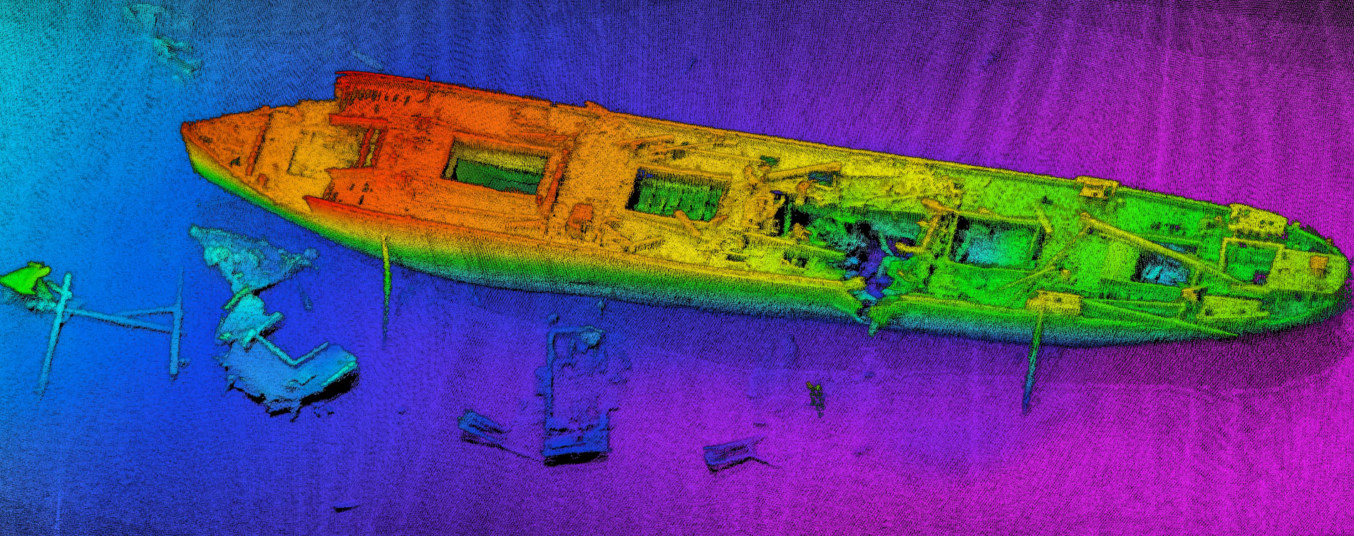
There was strong acoustic reflection from the steel piles and ambient environmental noise in the water column. Despite this, the NORBIT iWBMS provided clean data that was efficient to process, with robust and repeatable sounds despite multiple data lines. When the processing concluded, the project was exported as a point cloud for further analysis.
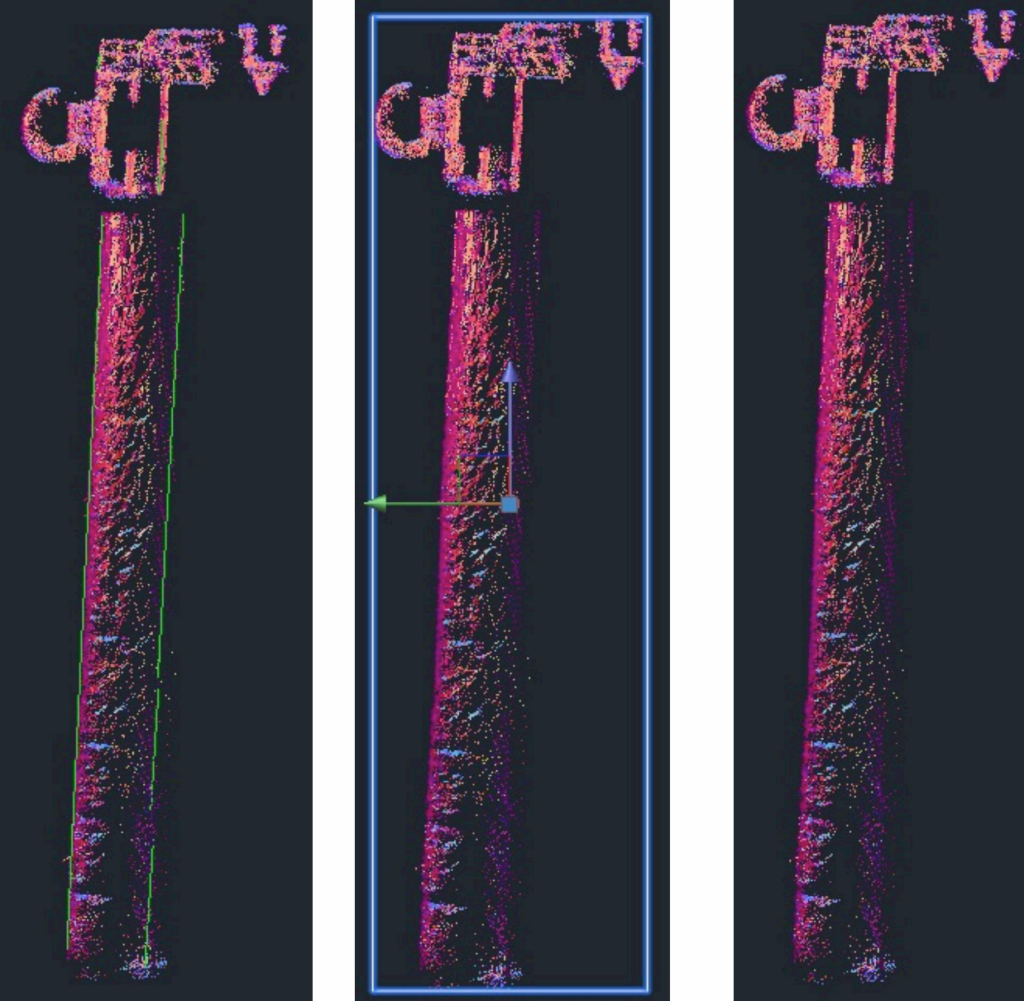
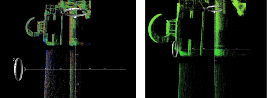
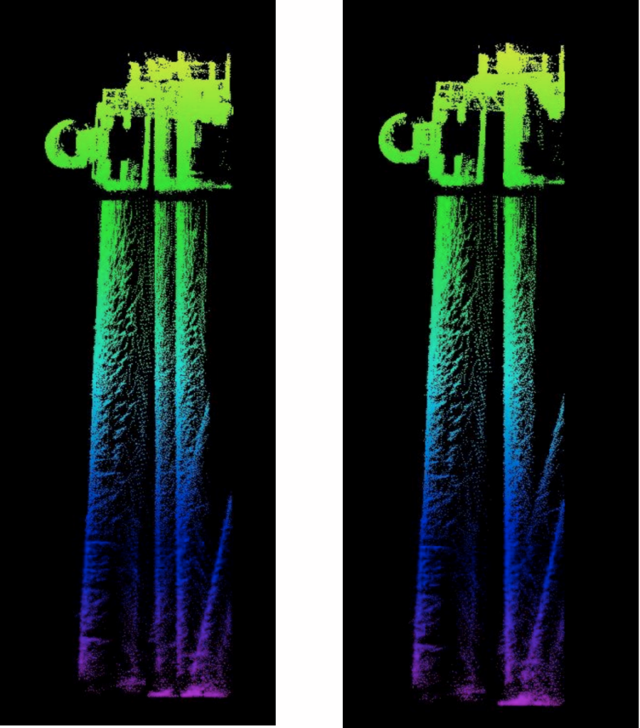
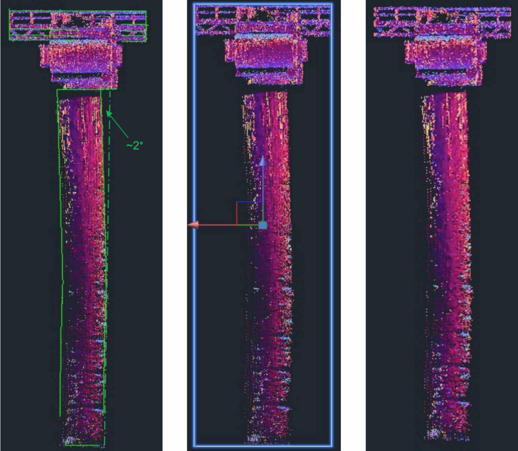
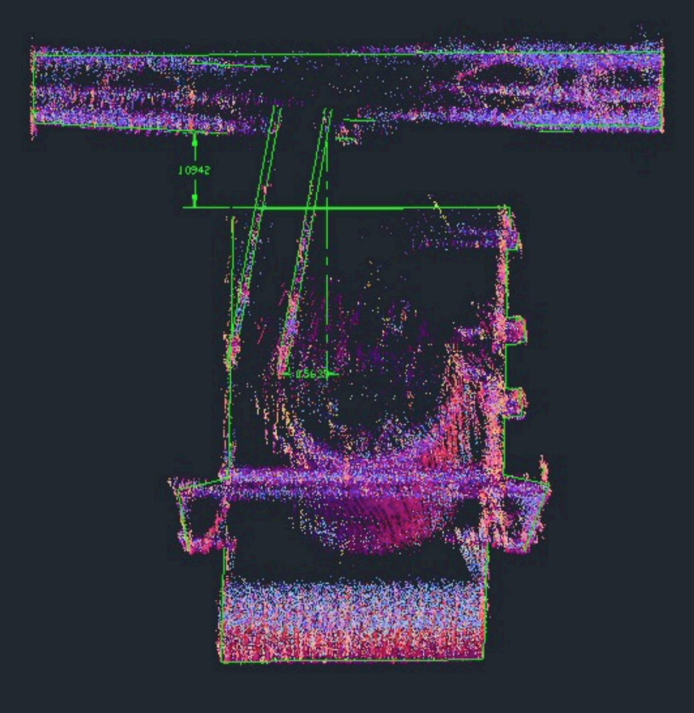
Once the damaged pile was identified, the survey showed with detail, the deformation created in the pile from the collision and allowed us to analyze the orientation of the damaged pile, while the lidar information allowed us to cross check the whole structure in plan view and affirm our findings due to the consistency of the above water movement with the below water deformation.
East view 090°

Conclusion
The integration of the two systems have proven to present an accurate and detailed
interpretation of the onsite conditions de facto.
- The linear consistency between the NORBIT multibeam and NORBIT iLiDAR system is
evidently supporting of and contributing to each other (each data set compliments the
other).
- Having used the same compensation system for both survey sensors allowed for a
good cohesion integration of the separated data sets, together providing a very
comprehensive report of the pile deformation.
- Additionally, the combined data sets were also used to confirm the visual findings that
arose from the diving survey and were also proven to support the diver’s
interpretation of the pile deformation arising from the visual inspection.