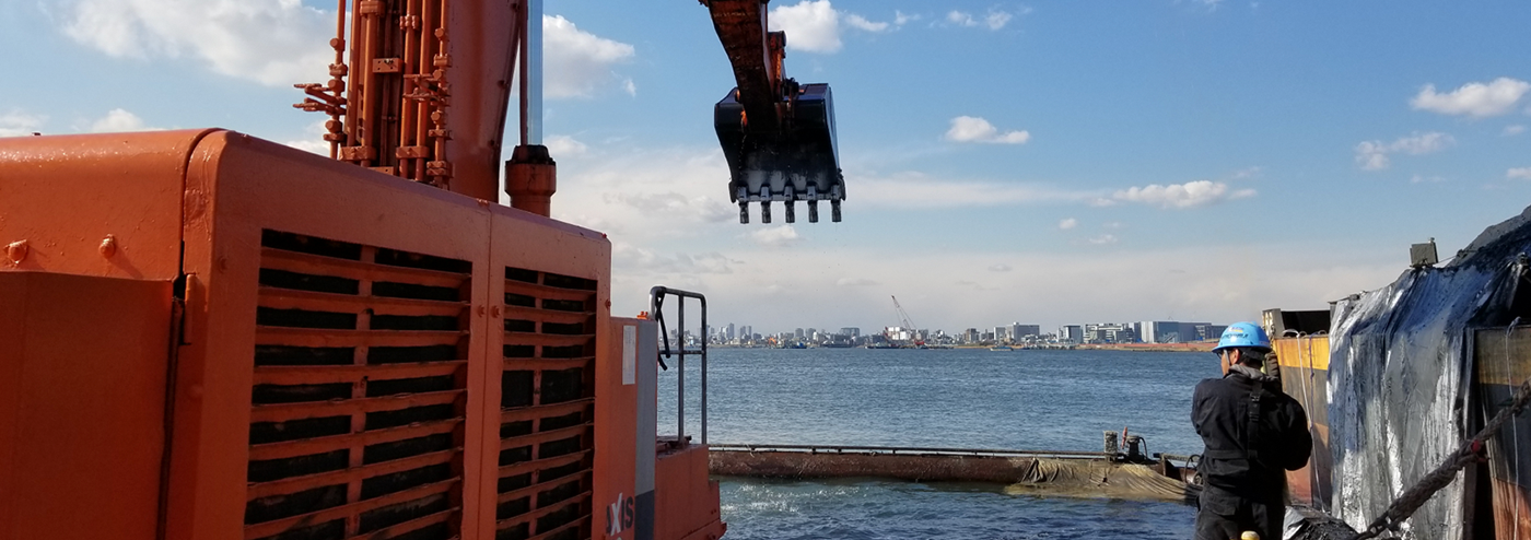
Bathymetric Surveying for Dredging
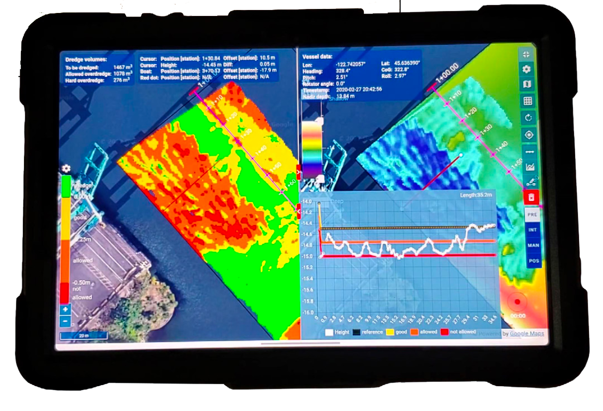
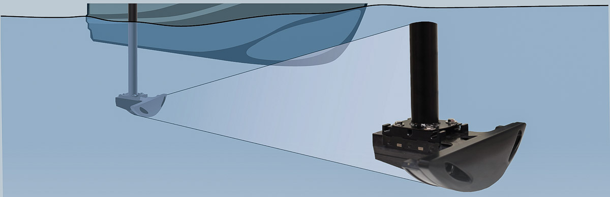
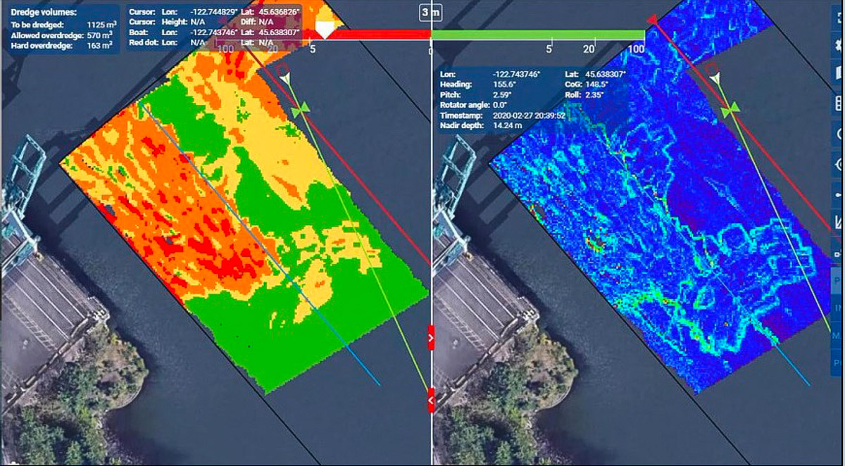
NORdredge software maximizes the benefits of using NORBIT integrated sonar systems to conduct bathymetric surveys for the dredging industry. NORdredge simplifies the survey experience and provides a concurrent work platform for vessel operators and hydrographers. The solution is suited for any remotely controlled vehicle (USV) or any type of surface vessel (SV) or boat of opportunity.
NORdredge, based on NORBIT’s OHP (Open Hydrography Platform), supports survey management and execution while simultaneously maximizing work efficiency and use of hydrographic expertise. A remotely located hydrographer performs the survey design and QA. Concurrently, the actual survey is conducted by available on-site personnel, such as the vessel skipper or designated USV operator.
NORdredge provides the dedicated communication link among personnel, ensuring critical hydrographic surveyor expertise is utilized when needed while the operator uses a simple handheld device to conduct the survey.
Survey Design and Management
The architecture of NORdredge has been designed to facilitate remote access and performing of advanced tasks by the hydrographer while the operator uses the handheld device to conduct the survey.
Remote Real-Time Access
The hydrographer’s process:
- Access the system on the USV remotely via web browser and sets up the mission.
- Prepare the design template according to the project requirements
- Prepare local station offset file and load into system so operator can easily see where to drive the boat.
- Draw survey navigation lines for the vessel, which automatically appear on the operator’s display.
- Identify potentially hazardous locations and communicate these to operator in real time..
- While operator conducts survey, the hydrographer can independently access the data and check coverage, plots, and profiles without disturbing the operator.

Local Survey Operation
The operators process:
- Uses the hand-held device to observe the hydrographers input.
- Once the survey plan is prepared, execute the survey plan and collect data.
- Confer with remotely based hydrographer and assess whether adjustments to the plan are needed.
- Confidently end data acquisition upon confirmation that survey requirements are met.
- The solution allows the operator to manage the execution part of the survey and communicate with remote expertise using a simple hand-held device.