Skip to content

WBMS X

Bathymetric Sonar System with Ultimate Flexibility


WBMS X product image

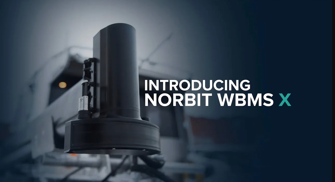
Redefining Versatility in Bathymetric Surveying

NORBIT WBMS X ultra-compact, high-resolution bathymetric sonar system is designed for Versatile Surveying.

Offering precision and adaptability, this cutting-edge, ultra-compact multibeam sonar system delivers high-resolution bathymetric data tailored to your unique survey needs. Built on a modular platform, it offers unmatched flexibility, and can be customised for any operational environment, ensuring optimal performance in hydrographic surveys, marine exploration, and underwater mapping, including SBG and Applanix GNSS/INS integration options.

iWBMS X Feature survey map

Read more about relevant applications

Hydrographic surveys

Subsea real-time monitoring

Oceanographic research and archaeology

Subsea construction

Software upgrade options:

Pitch Stabilisation: Real-time compensation for vessel pitch to ensure even sounding density in dynamic conditions

1024 Beams: Increase sounding density across track

Yaw Stabilisation: Real-time compensation for vessel yaw to ensureeven sounding density in dynamic conditions

Dual Swath: Doubles survey sounding density along track by transmitting two swaths per ping cycle

STX –Scanning: Rapid electronic transmit beam scanning to combine proven 2D bathymetry into 3D georeferenced bathymetry.

Data Acquisition & Post Processing: HYPACK, QPS, BeamworX, DCT, EIVA, and others 

Backscattering Strength Output: BSO provides fully repeatable backscatter results, as well as compatibility with physical models, for seafloor and habitat classification.

1.9 deg Version Opening angles: 0.9° X 1.9°@400kHz

Features
  • Configurable
  • High Resolution
  • Ultra Compact
  • Integrated sound velocity probe
  • Exceeds IHO Exclusive Order & USACE New Work
Options
  • Pole Mount: NORBIT Carbon fibre mounting pole (PORTUS).
  • Housing: Titanium housing
  • Cable Length: 2m, 8m or 25m (For longer cables, please contact subsea sales)
  • Fairing: For extra protection and improved flow dynamics
Applications
  • Coastal zones and offshore bathymetry
  • Harbor and lake surveys
  • Pipeline surveys
  • USV and UUV ready
  • Pond, river and estuary surveys
  • Dredging monitoring
  • Windfarm surveys

Videos

Introducing the WBMS X

Learn More - NORBIT STX Technology

NORdredge Video NORBIT

Survey of Newlyn Harbour with NORBIT Sonar system