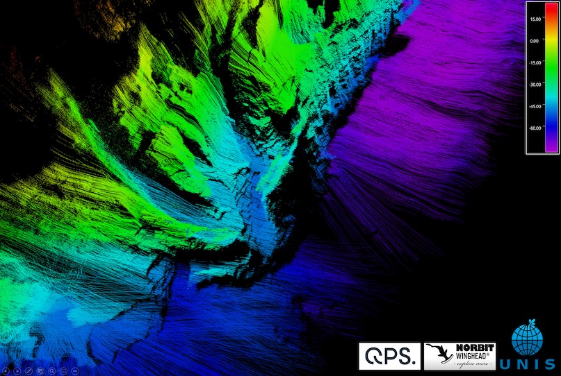
Glaciers and ice sheets are the main contributors to the rising sea level in the warming world, and ice loss from nearly every glacier on Earth is speeding up. Significant ice loss takes place at marine-terminating glacier margins through melting and calving, and because of the high risk related to field data collection this a poorly understood process.
- Geological, glaciological as well as oceanographic data are critical for better understanding of the dynamics of marine-terminating glacier margins, and for quantifying their contribution to sea level rise.
- Acquisition of data at calving glacier margins in uncharted shallow waters and in difficult ice conditions with traditional methods, such as crewed surface vessels, is time-consuming, costly and risky.
UNIS (The University Centre in Svalbard), Stockholm University and KTH conducted this data collection using the USV “Kuninganna” paired with our multibeam echosounder WINGHEAD i77h.
Read the Case Study HERE
Link to WINGHEAD i77h datasheet